Blog

06 Jul

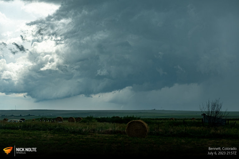
July 6, 2023 – Colorado Tornado From 15 Miles Away

July 6th featured another upslope day in Colorado as easterlies transported surface moisture into the foothills below strong mid level flow in the post-frontal region. Forecast models were showing CAPE values over 3k in Colorado with dewpoints in the mid to upper 60°F’s, which is kind of nuts. SPC was forecasting up to 3″ hail in the more intense cells, and it did look reasonably favorable for tornadoes in the Plains of Colorado south of I-70.

Read more
04 Jul

July 4, 2023 – Independence Day Chase

July 4th featured a local chase, so I was able to chase some storms without going too far for a change. A surface low in South Dakota with a cold front draped across Central Nebraska would provide the focal point for some local storms. I didn’t really have a big plan, so I just watched visible satellite from home then used that to decide when to leave.

Read more
24 Jun

June 24, 2023 – Southwest Iowa

June 24th was the final day of a week long chase vacation and this worked out since I had to be back in Iowa for the weekend. The storm system that we tracked the previous day had made its way eastward and a surface low was expected to move from South Dakota northeast while a cold front draped behind it extended into Iowa and Kansas to Colorado. This front would be the focal point for severe weather.

Read more
22 Jun

June 22, 2023 – Central Colorado

June 22nd featured two target areas. An MCS that traveled into Texas would leave an outflow boundary that stretched back into Northeastern New Mexico. Meanwhile easterly surface flow again would be present transporting moisture into the foothills from Southeastern Wyoming into Colorado. While the better tornado chances appeared to be in NM, I decided to hang around the Cheyenne-Denver corridor to be closer to Wyoming for the following day.

Read more